


Maps
2+ NEW ADVENTURES EVERY MONTH
click & go
ALL TRAILS ROUTES
3D
GOOGLE EARTH MAPS
insider
EARLY ACCESS
What's in every adventure pack
We take the guesswork out of
finding epic places
Every Insider pack is built from our own boots-on-the-ground exploration — so you can hike with confidence, not a question mark.

Click & Go Trail Routes
Custom AllTrails routes you open on your phone and follow turn-by-turn — including the off-trail sections most maps leave out.

Google Earth 3D Maps
Pre-built routes and coordinates dropped into Google Earth, so you can scout the terrain in 3D before you ever lace up.

Safety & Navigation Notes
Field-tested tips on water crossings, sketchy spots, and what to know before you go — the stuff we learned the hard way.

Early Access, Before Social
Insiders get coordinates and route details by email before they're released anywhere else — so you can explore them first.






WHO WE ARE
Hi, we're Shawn & Heidi
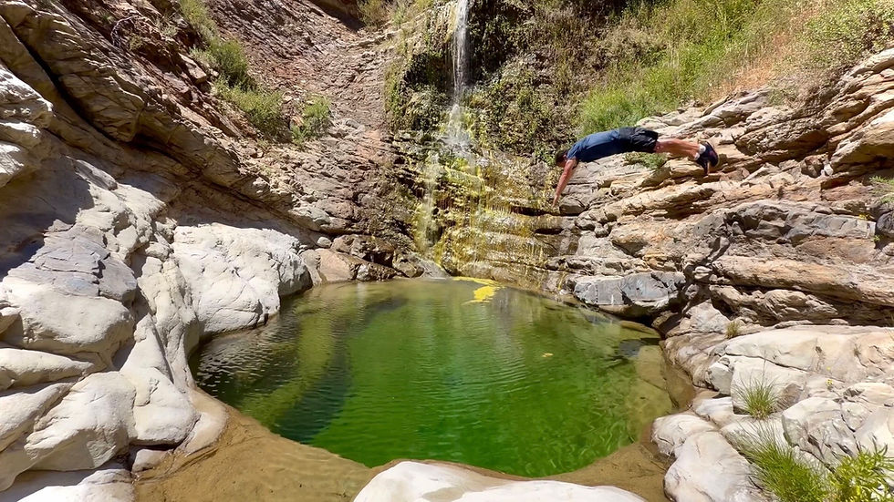
We're a couple who refuses to age out of the outdoors. For us, the best adventures are the ones just past where the crowds stop — the hidden pools, the unmarked canyons, the swim holes you have to earn.
We film every one of them, map every route, and share it all so you can go explore with confidence. Adventure has no age limit — and there's always another byte of it waiting around the bend.
Shawn & Heidi
@hikebytes • "Explore nature, one BYTE at a time"
FAVORITE PRODUCTS
THE PRODUCTS WE ACTUALLY USE
Buy from Amazon using our affiliate links to give us a small kickback

Foxelli Trekking Poles – Lightweight Collapsible Aluminum Hiking Poles with Quick Locks - Pair of 2

Topo Athletic Men's Terraventure 5 Comfortable 3MM Drop Trail Running Shoes

Foxelli Carbon Fiber Trekking Poles – Lightweight Collapsible Hiking Poles with Cork Grips
Sign up for our email updates
Get notified every time a new adventure pack drops, every time a new Youtube video drops, and all other exciting Hike Bytes news!
Unsubscribe anytime.
Disclaimer
Hike Bytes Adventure Pack — Liability & Risk Disclaimer PLEASE READ THIS DISCLAIMER CAREFULLY BEFORE USING ANY HIKE BYTES ADVENTURE PACK, MAP, ROUTE, COORDINATES, GOOGLE EARTH FILE, ALLTRAILS ROUTE, GPX/KML FILE, PHOTO, VIDEO, OR OTHER INFORMATION PROVIDED BY HIKE BYTES. Hike Bytes provides adventure-related information, maps, routes, coordinates, photographs, videos, Google Earth imagery, custom-mapped routes, and other resources for informational and recreational purposes only. Our Adventure Packs are designed to help you research and plan your own adventures. They are not a guarantee that a route is safe, accessible, legal, open, passable, or suitable for any particular person. ASSUMPTION OF RISK Outdoor recreation, hiking, exploring, swimming, scrambling, creek travel, snorkeling, climbing over natural terrain, and similar activities involve inherent and unforeseeable risks. These risks may include, but are not limited to: Falls, slips, trips, drowning, and other accidents Steep, unstable, or changing terrain Rocks, cliffs, loose soil, mud, ice, water crossings, and slippery surfaces Flash floods, rising water, changing creek conditions, and rapidly changing weather Heat, cold, dehydration, hypothermia, sun exposure, and exhaustion Wildfires, smoke, falling trees, rockfall, and other natural hazards Wildlife, insects, snakes, bears, mountain lions, and other animals Poison oak, thorns, cactus, stinging plants, and other native vegetation Remote locations where emergency assistance may be delayed or unavailable Getting lost, separated from companions, or unable to return safely Road, parking, vehicle-access, and trailhead hazards Changes to trails, roads, waterways, access points, and surrounding property Private property, easements, fences, gates, closures, restrictions, or other access issues Injuries, illness, disability, property damage, or death By accessing or using Hike Bytes Adventure Packs or related information, you acknowledge that you voluntarily participate in outdoor activities at your own risk and assume responsibility for evaluating and accepting the risks associated with your planned activity. INFORMATION IS NOT A GUARANTEE OF CURRENT CONDITIONS Hike Bytes makes reasonable efforts to gather and organize useful information, but outdoor conditions can change at any time. A route, trail, creek, road, parking area, property boundary, access point, or natural feature shown in an Adventure Pack may be different when you visit. Google Earth imagery, satellite imagery, mapping applications, GPS information, AllTrails routes, property boundaries, coordinates, and other mapping data may contain inaccuracies, errors, outdated information, or differences between the map and actual conditions on the ground. Do not rely solely on information provided by Hike Bytes for navigation, access, safety, or legal access. YOUR RESPONSIBILITY You are solely responsible for determining whether an adventure is appropriate for you and your companions. Before beginning any hike or adventure, you are responsible for conducting your own due diligence and verifying current information, including, when applicable: Trail and road closures Weather conditions and forecasts Flash-flood and water conditions Fire restrictions, wildfire activity, and evacuation information Current trail and road conditions Property boundaries and access rights Private-property restrictions Permits and regulations Parking restrictions Seasonal closures Wildlife activity Water levels and swimming conditions Local rules and land-management requirements You are also responsible for bringing appropriate clothing, footwear, navigation equipment, food, water, first-aid supplies, communication equipment, emergency supplies, and any other equipment reasonably necessary for the conditions and activity you undertake. If conditions appear unsafe, access is restricted, property is posted or closed, or you are uncertain about whether an area may legally or safely be entered, do not proceed. PROPERTY, ACCESS & BOUNDARIES Hike Bytes does not grant permission to enter private property and does not represent that every route, trail, road, access point, easement, or passage shown in an Adventure Pack is legally accessible to the public. Property ownership and access conditions can change, and mapping information may not accurately reflect current boundaries or access rights. You are solely responsible for determining where you may legally travel and for respecting all posted signs, gates, fences, private-property boundaries, easements, closures, and instructions from property owners, land managers, government agencies, or other authorized persons. Do not trespass. RESPECT FOR NATURE & RESPONSIBLE EXPLORATION Hike Bytes encourages responsible outdoor recreation and respect for the places we explore. You are responsible for following applicable laws, regulations, land-management rules, Leave No Trace principles, fire restrictions, wildlife protections, and other requirements. Do not disturb, harass, feed, approach, or interfere with wildlife. Do not damage native plants, trees, rocks, waterways, cultural resources, or other natural features. Pack out what you pack in, stay on appropriate routes when required, respect private property, and leave the area as you found it—or better. NO PROFESSIONAL GUIDANCE Information provided by Hike Bytes is for general informational and recreational purposes only. Hike Bytes does not provide professional guiding, search-and-rescue services, legal advice, medical advice, environmental consulting, surveying, land-surveying services, or official land-management information. Coordinates, maps, routes, photographs, videos, descriptions, difficulty ratings, mileage, elevation, timing estimates, and other information are provided as informational resources and may not be accurate or current. RELEASE OF LIABILITY TO THE MAXIMUM EXTENT PERMITTED BY APPLICABLE LAW, YOU AGREE THAT HIKE BYTES, ITS OWNERS, OPERATORS, CONTRIBUTORS, CONTRACTORS, AFFILIATES, PARTNERS, AND REPRESENTATIVES SHALL NOT BE RESPONSIBLE OR LIABLE FOR INJURY, ILLNESS, DEATH, PROPERTY DAMAGE, LOSS, OR OTHER DAMAGES ARISING OUT OF OR RELATED TO YOUR USE OF, OR RELIANCE UPON, ANY HIKE BYTES ADVENTURE PACK, ROUTE, MAP, COORDINATE, VIDEO, PHOTOGRAPH, GOOGLE EARTH FILE, ALLTRAILS ROUTE, GPX/KML FILE, WEBSITE CONTENT, OR OTHER INFORMATION. TO THE MAXIMUM EXTENT PERMITTED BY LAW, YOU RELEASE AND HOLD HARMLESS THE FOREGOING PARTIES FROM CLAIMS ARISING FROM OR RELATED TO YOUR PARTICIPATION IN ANY OUTDOOR ACTIVITY UNDERTAKEN USING OR IN CONNECTION WITH INFORMATION PROVIDED BY HIKE BYTES, INCLUDING CLAIMS RELATING TO ORDINARY NEGLIGENCE, TO THE EXTENT SUCH A RELEASE IS PERMITTED BY APPLICABLE LAW. This release applies to risks that are known or reasonably foreseeable as well as risks that may arise from changing outdoor conditions, inaccurate or outdated information, route changes, access issues, natural hazards, wildlife, weather, water conditions, terrain, or other circumstances associated with outdoor recreation. Nothing in this disclaimer is intended to waive or release any liability that cannot legally be waived or released under applicable law. YOUR AGREEMENT By purchasing, accessing, downloading, viewing, or using a Hike Bytes Adventure Pack or related content, you acknowledge that you have read and understood this Disclaimer, understand the inherent risks associated with outdoor recreation, and agree to accept responsibility for your own decisions, actions, safety, and conduct. Hike Bytes provides the information. You make the decision whether, when, where, and how to use it. Explore responsibly. Know your limits. Check current conditions. Respect the land. Hike Bytes — Unlock Adventure with More BYTES.